Wednesday, August 8, 2012

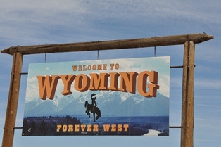
Wyoming - Day #3


After another early start, we met up with Bob from All Terrain Sports, who we had arranged to escort us to a mountain bike area called Happy Jack and to the climbing area Vedauwoo Rocks.  We loaded up the bikes and headed out. The trails at Happy Jack are great--very different from the technical riding at Curt Gowdy—with lots of flowing single track and only a few technical climbs (that kicked my butt). It was great hanging out with Bob.  He had great insight in to the local outdoor scene and knowledge of the local area.
Ryan, Bob's son, met us after the ride, and we headed over to Vedauwoo to set up a top rope and check out possible options for a ropes section. Vedauwoo is a granite formation that offers tons of climbing options.  We set up a top rope on a 50' face and Greg and I rappeled off while Mike snapped pictures.  After, Bob and Ryan showed their climbing skills as Bob led a 5.10 corner.  I struggled up the first one third on top rope before calling it quits. It brought back some great memories of avid climbing in my (apparently distant) youth--when I was a lot stronger and climbing conditioned.

We bid Bob and Ryan farewell, and we all scattered. Mike met back up with Dominic and headed back to Cheyenne to meet with sponsors and some other state officials.  Greg and I headed back north to tie in some sections of the course around Medicine Bow and work our way toward Lander for a meeting with NOLS the following day.


The possible route to a put-in on Seminoe Reservoir was beautiful, rugged, and desolate. Challenging terrain, for sure.

After stopping by Arcola Reservoir and taking a jaunt up Independence Rock we headed west to Lander.  With limited food choices along the way, we ended up eating pizza in a very local bar in Jeffrey City.

We arrived in Lander and checked into the Nobel Hotel, which is the lodging provided by NOLS for their students before they head out on wilderness courses.  The setup reminded up my childhood where I grew up in an Outdoor Education Center in Wales, hosting students for weekly stints in the Welsh countryside to do outdoor pursuits.  This may sound gross, but it was the smell that brought back those fond memories. After cleaning up we hit the sack to get some rest, ready for another new and exciting day in Wyoming.

Tuesday, August 7, 2012

Wyoming - Day #2


With an early start for another day of race development in the Wyoming sunshine, we broke camp and met up with Dominic and his family. They were going to be our guides for the day. We then met up with two ranchers, the Landers, who were kind enough to take us out and show us how real cowboys rustle cattle. This is something I definitely never witnessed while growing up in the mountains of Wales. It was worth the wait.

We then headed to Laramie and met with Bob at All Terrain Sports. We checked out his cool outdoor store and made arrangements to mountain bike and climb on Sunday. We then headed north to Medicine Bow, developing a route for racers and looking for a good TA for day 1 of the race as we drove. We found the perfect spot next to a small lake just outside of Medicine Bow.

With that settled, we followed Route 487 to Route 220, heading west to Martin’s Cove historic site, dedicated to the plight of the Mormons and other migrants who had headed West in search of a better life. The migrants used handcarts to pull their wares hundreds of miles across the vast plains.  Wouldn’t it be fun to have a handcart pulling challenge? We tried it out, and after only pulling the cart a short distance it really hits home how hard they had it.  Compared to surviving the Wyoming winters in the 1800s, a three-and-a-half day Adventure Race seems almost tame. We send a big thanks to Elder Smith and Sister Smith for their great hospitality and for showing us around the museum.

For our next stop, we headed back east and down Fremont Canyon.  The canyon is an impressive feature that connects the Pathfinder Reservoir with the Arcola Reservoir. It is a deep canyon with fast-flowing whitewater and steep walls that provide a great spot for some technical climbing. Sweet.

We turned south and worked back toward the Miracle Mile—a stretch of river famous for the abundant amount of fish and a favorite spot for fly fishing.  Dominic had gone ahead to throw some lines into the water with his kids to see if they could hook a few trout, but when we caught up with them they only had had a few nibbles and no real bites. No fish fry for us. We coordinated events for the following day, which took in climbing and more mountain biking, and then went our separate ways once again.

After another full day of exploring the wonders of the state, Greg, Mike, and I headed over the dam at Seminoe Reservoir, down toward Interstate 80, and back to our home sweet Wyoming home—the campsite at Curt Gowdy.  We had spent most of the day traveling on gravel roads and some very rugged terrain, covering more than 300 miles. Plans for the route and features that we could include in the race are beginning to take shape. One thing’s for sure--it is going to be a challenging race. Those cowboys are tough.


Monday, August 6, 2012

Wyoming - Day #1

REV3Adventure has been fortunate to partner with the state of Wyoming to put on an adventure weekend in July 2013 consisting of a 3.5-day Adventure Race that takes in some of the best and most interesting parts of the state, a family adventure race, a 5K glow stick run, and other festivities based out of the town of Casper.

With 11 months left for planning and preparation to make our REV3AR’s event, Cowboy Tough, happen, we headed west to Wyoming to scout out the courses and meet with sponsors and the team that was going to help make the event a reality.

Mike, Greg, and I had an early start from Dulles Airport, catching a 6 am flight to Denver.  After some fun and games (on the part of the car rental place), we finally got our vehicle and headed north to Cheyenne, the state capital of Wyoming. As the Rocky Mountains faded away to the left of us, we drove through the scrubland of northern Colorado and then into southern Wyoming. After a few stops for photos we arrived in Cheyenne and met up with Dominic at the state parks headquarters. Dominic is our contact with Wyoming and is critical to making the event happen. He is our eyes on the ground and the main go-to guy for local area knowledge.  Without Dominic, this thing would not be happening.  He is a great guy and we appreciate all his help.

 
After meeting up with a few potential sponsors, we headed to the state capitol building to meet Renee, the governor’s marketing director.  We discuss the upcoming press conference set for Monday, talk about the event and how it is going to highlight the state, and reiterate how happy we are to be able to work with the governor’s office to make the Cowboy Tough AR a reality.

After bidding Renee farewell, we grabbed lunch at Taco John's, where we sampled the famous "Tata Tots" and then headed over to Bicycle Station, where Wendy hooked us up with some great Specialized 29er demo bikes.

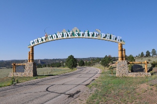
We were ready to ride, so Dominic ran us up to Curt Gowdy State Park, a super nice state park just west of Cheyenne.  After setting up camp we headed out to sample some of the trails the park had to offer.  The trails were very similar to trails on the West Coast--loose with a mix of rocks and switchbacks—and enjoyably technical.  The one thing none of us had taken into consideration was altitude.  At 7500' and coming straight from sea level on the East Coast, we all felt the burn in our lungs as we tackled the hills. After about 10 miles of trail riding, we headed back to the campground, cleaned up, and headed into the town of Laramie for some food and supplies.

We finally hit the sack at around 11 pm (1 pm EST), making for a long—but exciting—day of exploration. We are pulling together what looks to be a fantastic, unique, and fun race. Tomorrow brings cattle rustling and a tour of the reas north of Cheyenne

Tuesday, July 24, 2012

Rev3 - Green Ridge Adventure Challenge - Race Report

Green Ridge Adventure Challenge – Race Report
July 21st, 2012
Team: Britt, Greg and Michael
Written by Michael Spiller

The Green Ridge Adventure Challenge took place in Green Ridge State Forest near Cumberland Maryland.  Kevin Howser  and Hutch from the Cumberland Trail Connection Adventure Racing team were the race director.

The Green Ridge Adventure Challenge was my first team race in two years after coming back from shoulder surgery last season.  I was also racing with Greg Voelkel one of our teams fastest racers and Britt who is 21 years younger than me.  I knew this race was going to be a challenge because of the terrain in this area of Maryland has a lot of elevation.  After seeing the course I decided the mountain were twice the size of what we used in the Epic Race this past year.  It seemed that the only flat section was going to be the paddle section the Potomac River.

The team met up on Friday night for the team check-in.  Britt drove 10 hours from Illinois and Greg flew up in a plane from Florida for training mission for the air force and I had a short 2 hour drive from Northern Virginia.  Greg was delayed because after landing there was another plane that was landing that had a higher priority than Greg so he was delayed getting to Cumberland.

We arrived at the Race course at the South End Rod and Gun Club near Oldtown, Maryland at 5:30AM on Saturday morning and prepped our gear for drop locations provided by Cumberland Trail Connections.  They were going to drop our paddling gear and bike at two different locations to be picked up during the race.  At 7:00Am they handed out the preplotted maps and Greg and Britt laid out our strategy for the race.  The race course was going to be about 65 miles with paddling, running, and mountain biking.  Seem like it was going to be a fast course with lots of ups and downs during the day.  We were extremely lucky because it was raining and the temperature dropped from the high 90’s to the mid 70’s and it raised the river level for the paddle section. 

At 8:00AM the race was started and we needed to hit two trekking points on our way to the river to pick up the canoes.  Scott Pleaban’s two person co-ed team was in front and we soon fell into second place and hitting both points and running the whole time.  It was a few miles to the river and we arrived to see Scott getting into the water.  However our paddling gear had not arrived yet and we were searching for our paddles.  Kevin sent some of his crew back and they found our gear and gave us a 16 minute time credit while we waited for our gear.  About 10 teams came in and they were hitting the first Checkpoint on the water.  Kind of killed our mojo but we knew we would be slow in the water because we had rented a canoe and the teams in front of us had their lightweight canoes so we didn’t want to fall too far behind.  We received our paddling gear and started paddling to the first CP upstream.  We opted to run and swim instead to the checkpoint and passed several teams and moved into 5th place.  As we paddle downstream we passed one more team and moved into 4th place behind Scott Pleaban, ARMD and GOAL’s.  Once got off the 5 mile paddle we picked up our bikes and now my bike helmet was missing.  We spent 5 minutes looking for a helmet and Kevin once again stepped in and gave me his helmet so I could continue racing.  We took off on the C&O canal to go through the Paw Paw tunnel.  It was pitch black in the tunnel so we needed to pull out our lights to even walk our bikes through the tunnel.  We arrived at the first Orienteering course and we were 34 minutes behind the lead teams.  We opted to scramble straight up a hill instead of taking the trail to the first checkpoint.  I knew it was going to be a long day and the legs were going to be hurting.  We ran to every checkpoint and Gregs navigation was on point.  The coolest checkpoint was an old train tunnel in the middle of nowhere in the mountains.  Of course we came out on the top of the mountain and had a very challenging climb down to get the checkpoint.  We cleared the course and moved into second place only 5 minutes from the lead.  Now we were on our bike and this was going to be our strong section of the race.  However we missed the first biking checkpoint and rode four miles out of our way and now dropped back to 4th place.  We rode up mountain to great overlooks and down mountains to different landmarks and felt pretty good until a logging truck started coming up the road.  Greg stopped, I slid to a stop and Britt slid into a stop but hit me in the process and fell off her bike.  She cut her leg, cut her chin, and cut up both hands and we originally thought she broke her finger.  She also bent her front derailer.  We spent some time checking her out and she felt like continuing and was bleeding from three different spots.  This girl is tough.  I would have been crying and quit the race.  We continued on to the next trekking section.
With all our mishaps we still only 3o minute behind the lead team and we had a 21 minute time credit at the end of the race.  However what this really means is that we need to run the orienteering course to catch the lead teams.  Once again we hit the first two points and we were making up time on the lead teams.  My legs were screaming and it was still raining, so we were soaking wet.  We moved into 3rd place and knew the lead team was only 10 minutes ahead of us then we were talking and overshot our attack point by a ½ mile.  Greg somehow found the right reentrant for the next point and we picked up the last point and headed back into the bike transition.  We passed the GOAL’s team on the way back to our bike and moved into 3rd place again and hit our bikes to try to catch the lead teams on our way to the finish line.  It might sound easy but we were on an ATV trail and it had tons of trees down, lots of mud, slipper rocks, and of course lots of climbing.  It took over an hour to go 3 miles.  Then we needed to climb to the highest point in the race for a 2 point bonus checkpoint.  Did I want to get it?  NO!!!  But we did and as we climbed we saw ARMD coming down the mountain.  We had made up over 20 minutes on the bike section and now they only had a 10 minutes lead.  With our time credit we were in front by 11 minutes.  We rode hard for the next section of the race to the finish line and were only a few minutes behind the lead and with our time credit we were in first place.  We had three bonus points to hit by the 8:00PM cut off and victory was ours.  However it didn’t play out like that.  We hit the first point with only a minor mistake and then went for a low point because we thought it would be the easiest.  We spent 25 minutes trying to find the point with no success and had to go to the finish line with only one bonus point.  Kathy’s ARMD team hit the high point and the river point so they were able to pick up one more bonus point and won the co-ed elite division.  We found out that the UTM’s for the point we were looking for was off and Greg almost found it but turned back because the area he was looking was too far off the description.  However, that Adventure Racing, mistakes happen and as a race director I know Kevin and his team put on a great race.  The best food ever was server at the end of the race with Sloppy Joes, homemade Mac and cheese, BBQ beef, salad, fresh corn on the cob and a keg of beer.  Our journey took us over 70 miles and to me it was an excellent day with great teammates and I would not change a thing.

Wednesday, June 20, 2012

Run Row Rock and Roll Adventure Race


By Michelle Thompson   
This weekends race started with Dave and me meeting at the Fairbury wellness center Friday. We received our maps and race instructions and begin preparing our maps for the Run Row Rock and Roll adventure race in rural Fairbury, Nebraska. This race was designed by and directed by our teammate Craig. Everything seemed pretty straight forward. We had a brief race meeting at 8pm and then we were off to meet Micah. Craig once again arranged for us to stay at his friends Jack and Jackie's beautiful home. It's like having our own apartment when we are there. A great way to start the race experience!
We reviewed our route and did a few more race preparations then called it a night.

We woke at 5 to very loud thunder and big bolts of lightening. We loaded things up. And we're off to the bike drop. The rain, that was forcasted to fall all day, stopped but clouds remained. We were shuttled to race start on the "redneck subway" which was a cattle trailer. I can only imagine what the passersby must have thought.

The race started at 7:30 with a running section followed by a canoe on a lake, trek/run and then, the most enjoyable part, a 1/2 mile canoe portage through a muddy ravine and woods. Then we were off on a short river paddle ending at the bike drop. This section was titled "Swamp Thing."
At this point there were 3 teams in the lead including us.

We took off on our bikes riding on mostly gravel roads, up and down, but mostly up,up, and up. Don't believe it when you hear Nebraska is flat. Craig was able to design the course so we had the pleasure of doing a 1 mile long climb. Thanks Craig , that was fun! The next section titled "Cabin By the Lake" started with a team challenge. This challenge was log sawing done by 2 teammates while the other steadied the log. No problem. I'm sure it was because of my superior steadying skills. Then it was off on an orienteering section. This section was not given to us until we arrived. This included 5 points. Once completed we were off on the bike again. This included gravel and pastures. At this point we were neck and neck with a solo racer.

This next section, "The Hills Have Eyes," started and ended on bike but was primarily a trekking section up and down some steep creek banks and through lots of poison ivy. Yikes! Near the end of this section Craig had a surprise for us. It was a time trial on a very, very steep hill. The male and female winners would get $80 in prizes. The guys decided they would help me win. I hooked the tow up to Dave and Micah pushed. Up we went. Dave was an animal. I felt like I was working hard but Micah said he had never seen the tow pulled so tight. We were glad that quickly came to an end and we were off on our bikes to the next section. What a nice surprise Craig. Thanks for thinking of us.

The next section, "The Bucket List," began with an orienteering section then a paddling section on a small lake. We decided we had better do the land section first. After all that hard climbing we werent sure if we would get up if we started in the canoe. We got 4 points on land, 1 which could have been really tricky but Dave was spot on.We decided to do the team challenge next. This was an attempt to " walk on water." Two large buckets were given to each of us. We were then supposed to stand in them, one on each foot, beside a rope that crossed a small cove of the lake. We were then supposed to pull ourselves across the water without falling. Dave and Micah both satisfied Craig's wish and proceeded to quickly plunge into the water. I, however, decided to straddle the hip high rope and pull myself across. Success. Then it was off to 3 more points in the canoe.

We were all anxious to reach the finish line. We were now in 1st place but knew the racer behind us was fully capable of catching us on bike if we did not push hard. We had 1 more rural section titled "Live Free or Die Hard." One point had been taken out due to all the rain. One point remained. Then it was back to the city of Fairbury. Once we reached the city we had 2 Cps to find. We had familiarized ourselves with the city layout the night before so felt pretty confident there would be little hesitation. From a distance we could see the railroad crossing light begin to flash and the crossbars descend. NO WAY! As we got closer we realized it was only 1 car. What a relief. We grabbed our last 2 points and headed to the finish. Finish time 7 hours 12 minutes.

Nice job guys! Almost flawless navigation from Dave, a strong push on the run and bike from both Micah and Dave, and great teamwork in transitions pulled us into and kept us in the lead. Believe it or not Craig, you did such a great job with this course we don't even have any suggestions. Only, could you throw in a few more climbs next time!?
Next up Big Mountain Adventures 24 hour in Colorado Springs next weekend. Bring your O2.

Friday, June 8, 2012

GOALS Cradle of Liberty - 24 Hour

GOALS: Cradle of Liberty 24 hour race
This year the race was held in southeastern PA.  Now if you look at a map of southeastern PA, there’s not a whole lot of “green” park area, but the race directors did a fantastic job of finding every nook and cranny for the racers to explore so that we really did feel like we were out there..and not 5 minutes away from a gas station.  This race our team got shortened last minute from 3 coed to 2 male.  John and I were disappointed to not be able to race in the premier division and get points for the team, but we were still committed to giving the race everything we had and having a good time.
looking over maps last minute before the start
Our cars were parked at Evansburg state park, which is where the finish would be.  After registration, packing food and loading paddle bags and bikes onto a truck, the racers had a short meeting and we all got on a bus to head to the Hopewell Furnace national Historic site, where we would start the race at 9:30.  The morning was chilly, but the sun came out to warm us up shortly and we were thankfully granted great weather for the rest of the race! 
Plotting checkpoints after the prologue

The prologue consisted of 3 relay legs on foot. Each leg had to be done by only one racer of the team.  The first leg had the racers run to pick up some coordinates of mandatory checkpoints that would need to be plotted for later in the race.  The second leg had us running to pick up our passport, and the third leg got us the map with pre-plotted checkpoints for French Creek state park, which would be the first foot orienteering leg of the race. 

After plotting the rest of the mandatory checkpoints we were off racing.  The overall course consisted of over 100 optional checkpoints, and would not be clearable, our strategy would be to start off clearing as much as we could, but not wasting time searching for a CP if we were having trouble with it, because each one was worth only 1 pt.  We attacked the first leg in a CCW format, aiming to clear every point.  John was navigating, and his sense of direction was dead on.  We were checking off CP’s one by one with ease and never had to spend more than 5 minutes searching for the flagging when we were in the area of the CP.  We spent 3 to 4 hours on the first leg.  Having cleared our last checkpoint, we were running back to the TA to pick up our bikes and head out.  On our way there we saw SOG and GOALS leaving on their bikes, so we knew we were doing pretty well and could not be too far behind the leaders.

Starting the first trekking leg

A quick bite to eat while we put on our bike shoes and we were off to Birdsboro park.  The ride there was on roads, and practically all downhill.  John and I remarked that all bike legs should feel as good as that!  When we arrived at Birdsboro, we dropped our bikes, changed back into running shoes and headed into the park.  The entrance to the park is a wire bridge that spans a creek.  It’s always fun to try something a little out of the ordinary, so when John and I both got on to the bridge, it was apparent that we were both a little too tall for the spacing of the wires, and having two of us on at the same time did not give us any benefit in keeping it stable.  Thankfully we were able to cross without taking a dip, and we headed into the park.  On our way in, down an abandoned road, we blew past the entrance trail to the first CP, but we would be coming back that way, so instead of backtracking we decided to just get it on the way out. 

Crossing one of the cable bridges into Birdsboro


The park was essentially divided into two halves by an abandoned road.  The northern half had a bit more elevation change, and a closer grouping of CPs, and the southern half was far more spread out.  We decided to go after the northern half first, because the high density of CPs would let us get more points more quickly, and if we needed to cut out of the park to hit a time cutoff, we wouldn’t be losing much.  We made quick work of the first few checkpoints in the climbing crag area and surrounding hills.  As we were headed to the last cp in the grouping, we went a little too far down the trail, and had to adjust our attackpoint accordingly.  I think this was a mistake, we should have backtracked to our original attackpoint.  We were searching for the last CP in where we thought it had to be.  The clue was “boulder” and we were in an area of the woods that was suddenly populated by large boulders, but after 20 minutes of looking, we still hadn’t found it.  We decided that it wasn’t worth any more time for 1 point and we should move on to the southern end of the park.
This area of the park went fairly smoothly.  We decided to forego 2 CPs that were much further out than the others, because we wanted to move on to the next section and didn’t want to spend the time.  After getting back to the access road, we knocked off our last CP (the one that we passed earlier) and crossed back over the wire bridge to get back on the bikes.
We biked north on a mix of roads and rail trails to Neversink Park, which is on the southern outskirts of Reading, PA.  The map for this section had a large number of CPs, both mandatory and optional, and we wanted to get as many as we could, while still making an 11 pm cutoff to get in/out of the next TA at the top of Mt Penn in reading. 

 After a quick analysis of the map, we decided to attack the park in a CCW fashion.  One of the exits of the park had a McDonalds marked on it by the race directors, and we decide that we would give ourselves a little reward after getting out of this section.  The trails here were all bikeable, some were a bit too steep and had to be hikeabiked, but it provided for faster moving over trails then the previous two legs, which was a nice change of pace.  At the entrance there were two CPs on opposite sides of the trail, which ran through a ravine-like topography.  Most teams were dropping their bikes and going after one, then the other.  We decided to drop bikes for only one of the CPs, and then hike-a-bike up to the other, because it would prevent us from spending time backtracking.  I think this move helped us to save a lot of time and was a good choice because a little bit of bikewhacking got us onto a great open trail that was fast and took us everywhere we wanted to be. 
From here we made the decision to go for the most difficult CP in the park.  Thankfully it was still light out and that made it far easier to navigate.  We dropped our bikes and slogged a couple hundred vertical feet up some overgrown powerlines, crossed a road, and headed into some woods where the CP was located on a small ridge.  We were able to locate the tiny ridge (maybe 10-15 feet high?) and find the CP, which only took a small amount of searching.  After getting it, we booked it back to our bikes and continued on the fast trail that circumnavigated the park to check off more CPs. 

It was becoming apparent that we were not going to have time to clear this portion of the course and still make the cutoff.  So we started to make our way out of the park, getting the CPs that were along our course of travel.

when we made it out of the park, we did make a quick detour to McDonalds.  I knew we were pressed for time.  But I feel like this was the right choice.  We had been going for 12 hours now, and were craving something besides race food.  We shoved down 3 burgers each, and 2 large cokes, refilled our water bladders  in the bathroom, and headed out.  I have to say that it was one of the best burgers I’ve ever had, and I felt so energized.  Definitely the right choice.


The TA at Mt Penn had an 11 PM cutoff, and we had a large, formidable road climb ahead of us to get there.  I think it turned out to look a lot worse on the map, because we had allotted ourselves close to 2 hours to get there, and it ended up only taking 1.  That was good news, because it meant we wouldn’t have to immediately turn around, but would be able to go out for at least one optional CP at the Mt Penn area.  When we got to the TA at the top of the climb, we were informed that the 20 mile paddle leg for that night was cancelled because of flood conditions on the river.  We had seen the river at a couple points throughout the race and it was HIGH and moving FAST.  I have to say I was a bit relieved, because I wasn’t exactly looking forward to a night time paddle where it would be difficult to control/stop/unboard and board a canoe in such a fast moving river.  Instead we would be biking the same distance, and a few of the mandatory and optional CPs on the paddle would be removed.
Coming into the Mt Penn TA at 10 PM

With that news, we threw our running shoes on and went out to snag one CP before we had to leave Mt Penn for the 11 PM cutoff.  We did just that, and headed out.  Back down the hill (which surprisingly took far less time to go down, than up =]) and then back into Neversink park, to go up over that hill, and to check in at the Paddle TA, where we would receive further instructions on the night time bike course.

On this road portion of the bike, we caught up with NYARA and Carpe Vitam.  Our three teams stayed together, forming a paceline, and we were all able to blast through the section.  I cant remember ever going this fast on a bike this far into a race.  It was awesome being able to work together and have each racer take their turn setting the pace and pulling.

We got to the TA and got our instructions for biking to where we would have been pulling the canoes out of the water.  It was roughly 20+ miles of road.  John and I went through our food stash in our paddle bag to refuel and restock our backpacks, and then got on the road.  Both NYARA and Carpe Vitam had slightly quicker transitions than us, but we were able to catch them and get back into the same paceline. 

During the ride, I was setting the pace, and then John took his turn right behind me.  I guess I didn’t notice until it was too late, but we had lost Carpe Vitam, and then shortly after NYARA had to pull off and go their own pace as well.  So then it was back to 2.

While riding, John and I got a craving for a 3am cup of coffee as we passed a gas station.  So we decided to take a quick detour and get some.  I know this is not typical for adventure racing, but having resources like this was really enjoyable.  Back on the road, we pushed on to the next TA and were able to give our bike seats a rest.
The Park at Lock 60 is surprisingly small, but somehow GOALS managed to cram an impressive foot orienteering course into it.  John and I went through and cleared the section one by one.  By the time we were done and back to the TA, the sky was starting to go from black to blue, and I knew that I would be getting a second wind shortly as we headed into the second to last leg of the race.
We had a choice to bike directly back to Evansburg state park, and go for some optional there, or go after more optional on the bike.  We opted to stay on the bike, because we felt like we have kept a consistently good pace and were happy with it.  The optional checkpoints led us through some interesting abandoned roads, and into a small mountain bike park.  At the one optional checkpoint here, we got a map of the surrounding trails which had 5 or 6 more optionals shown on it.  Since the trail area was small, and included a lot of elevation, we decided we could do it faster on foot.  So we quickly dropped the bikes and put on shoes to head off onto the trails.  We cleared every optional but one, which we chose not to go for because of its distance and out-and-back format.  We decided to head back to evansburg and try for some of the optional there, which could be closer.
The quick ride back to Evansburg brought us to the finish line, but we weren’t done yet.  We had an hour and a half to go, and had our choice of 2 different courses.  One was a “memory orienteering course” where we got to look at a map, and then had to go find the checkpoint by memory.  At that point there would be another map, and so on. 6 cps for a total of 3 points, and you had to clear it to score the points.  The other course was another relay orienteering course. 3 separate stages, easy/medium/hard with each stage being worth a few points each (again, had to clear the stage to get the points)  after a short debate with john, we decide to do the relay, because my brain was not working as well as it could be after racing for almost 24 hours.  John took the first leg and got back in 30 mins.  So I went out for the second leg.  I had an hour to clear it.  Which wouldn’t be a problem.  It took me a few minutes to get used to the scale and orientation of the map, but once I had a feel for it, I was on my way.  I managed to clear that course in 45 minutes.  So with 15 minutes to spare, we officially finished.   

John waiting for me to finish the last orienteering leg

We washed our legs down with some tecnu, ate some pancakes and sausage, and stuck around for awards to find we placed 1st in class and 3rd overall behind Team SOG and Cumberland Trail Connection.  This was a great race for John and I.  Overall I think it went well, but looking back at it I can pinpoint areas where I know we lost time and we could have made better choices.  Each race I learn something, so hopefully next one I will be faster.

Success!


Monday, May 28, 2012

Wild Wonderful 2012


The team
I had missed last years Wild Wonderful by Odyssey Adventures and was psyched to be heading back to West Virginia to take on the 2012 race.  A favorite of mine because the water section is Class 5 rapids.  Extremely exciting and also means no water section that requires hours of paddling in a canoe, which I hate.

 I arrived at ACE Resort, the host location and met up with Greg, Dave and Sandra.  I had not met Sandra before and her bubbly and fun attitude was gonna help her get through her first 24 hour race.  Dave and Greg are old hands to the 24 hour scene I was glad to be racing with such strong and experience guys.

 After check-in we headed back to our hotel to plot and dissect the course.  I had done the WW twice, Greg once and Dave was on his 4th or 5th go around so between us we knew the terrain and proposed course fairly well.  There were some new areas to be explored and the focus was heavily on Kaymore Top, an area we had only passed though on previous races.  Ronnie, the Race Director had set up a challenge trek section following the White Water with a 20-25 mile hike up and down the gorge, followed by a mountain bike course, then a foot O, then a long bike with optional points to the finish.  Mandatory points were required to remain official and we knew that it would be almost impossible to clear the course. With everything plotted, checked and double check, we packed gear for the day ahead, attended the pre-race brief and then managed to a get a descent night sleep.

Pre-race nerves
With a 6am start and we back at ACE with bikes,  staged our gear and loaded onto the buses for a short ride to the put-in.  It was great to see so many familiar faces that would be racing along side us.

With a three wave start we were drawn to be in the first wave.  We loaded into the 8 person rafts and paddled out into the very high and raging New River. Ronnie gave the signal and we were off.  We were in the boat with a 4-man team and tried to preserve energy as we headed down through the rapids.  Its tempting to go balls to the walls to get down the river first but no matter what the separation between boats, it is only a few minutes and over 24 hours that ain’t nothin.

Warming up for the rapids
 At take out we transitioned quickly and headed out onto the trek. After CP3 we know that we would be behind the lead teams as Sandra’s trekking was not as strong as her biking.  Sandra is a world class endurance mountain biker and is a lot more confortable in the saddle than in a running shoes.  We knew this going into the race and planned accordingly although the long initial trek was defiantly not in our favor.

 Dave’s navigation was spot on and we worked our way around the trekking points.  Ronny and somehow managed to find a flight of 800+ stairs for us to go down and backup living up to his motto “Our pleasure is your pain”. Thanks Ronny. We did see the lead teams on some out and back sections.  They were going hard and were probably a good 30-40 minutes a head of us by the time we go to the bike transition.

 The first trekking leg took around 4 hours and it was early afternoon. We made a quick transition to bikes.  We guessed at that point we were in the middle of the pack.  Sandra’s biking skills started to pay off as we took on the most excellent single track that had been recently cut. Biking is always my favorite part of the race and I fully enjoyed the trails.
By the time we finished with the single track and arrived at the O-Course transition we still had daylight, which is a huge advantage.  We had also made up a massive amount of time and were the third team into transition. Sweet.

We decided to take on the hardest points first.  These were the ones that were a long way off the trail and would require good compass work and pace counts to nail. We had no plans to clear the O-Course but had a strategy to work the course leaving the easiest points, but some of the furthest away for the end.  We knew we had to make a 6am cut off point that required a long bike to get to and wanted to make sure we had time to do this.  We set a goal to be off the O-Course by midnight.  Dave once again did a great job navigating (once we had the correct declination set) and we spent some time working through 3-4 of the points with Mark Lattanzi for Odyssey who was crushing the course as a soloist.
As the night drew in and the day’s heat subsided we managed to pick up our pace and realized we would be able to complete the O-Course if we didn’t head out on the last bike section until 1am.  We took the gamble that we would make the cut off, pressed on and cleared the O-Course. With a two points back toward the bottom of the gorge and another requiring a 4-mile out and back, we struggled on, kept fueled and hydrated and kept the pace steady.

Stairs of death
Back at the transition after about 12 miles of trekking we geared up and moved back to bikes.  We moved the transition quickly spending less than 10 minutes getting ready. We made once last water stop at a stream that we had been using for water supply and headed out.

The ride back along Kaymore Top was refreshing.  Mostly down hill or flat we worked our way around the gorge and back towards ACE adventure resort. We didn’t see any other teams until we came off the trail and we started the hike a bike up to CP 21 with a few other teams.

The trails through ACE can only be described as a spaghetti mess of mud and puddles.  We took a wrong turn but managed to do some heavy bush whacking down an over grown trail to get back on course and get to the cut 6am cutoff with 40 minutes to spare.  Unfortunately Sandra’s bike sustained a broken chain on the way slowing progress.  Note to self, quick links don’t work on XTR chains and XTR chains are a pain in the ass to repair.

We ran into the Odyssey team at the cut off and headed out before them but got waylaid with some lights dying.  After distributing some lights between the team we were off again and heading out for CP29, a long haul with some serious hill climbs. We were neck a neck with Odyssey who we assumed had also cleared the O-Course and probably picked a couple of optional points on the mountain bike section. With only two optional points to get we know we would have to get at least one, if not two too be able to take the lead. We traded placed with Odyssey down the trail and eventually arrived at CP29 slightly ahead.  With time running out they opted to not get the final optional points.  We decided to go for it and headed out along a very overgrown trail to get the optional points. Disaster struck once again with the XTR chain breaking in the same spot.  With time against us at this point we got the chain repaired and decided that we were not going to get the optional points we needed and started heading back to be able to finish before the cut off of 9am. With a weakened chain that we ere concerned would continue to blow out, Greg did some impressive towing to get Sandra back up in the ACE resort and to the final check point.  With a final down hill to the finish we completed the 2012 Wild Wonderful with about 30 minutes to spare.

Odyssey managed to get an extra optional checkpoint and took first place the Coed division and we took second.

It was a challenging course.  No one cleared every checkpoint and out of 40 teams who started only 14 officially finished.  For this race, Odyssey Adventures truly lived up to their motto “Our pleasure is your pain”.
Finish line