Sunday, March 4, 2012

Skunk Ape 24-Hour Adventure Race

The Skunk Ape 24-Hour Adventure Race was held in southeastern Florida, near the city of Jupiter, on 4 Feb 2012. I was well rested and ready for this race, my first solo event since Checkpoint Tracker nationals last October.

I drove down from my home near the Kennedy Space Center the night before, checking into race HQ in Hungryland Wildlife Management Area. Teams and soloists were provided maps and a clue sheet then sent off until the pre-race meeting at 0600 the next morning. At the race director's recommendation I had booked a campground for the night (local motels were over $100/night and as a soloist I didn't have anybody to share the costs). Since my campground was over 30 minutes away I elected to pitch my tent at the race HQ and save the drive time. No teammates to smell me as I raced, who needs a shower??

2 reasons why that was a bad idea.

1) It rained that night, and rained hard. Ever try to sleep in a tent with wind driving rain? Not easy, but I tried hard until...

2) Local kids arrived around 2am. Monster trucks, stereos blazing, they circled my tent a few times and did some doughnuts in the grass. I stayed in the sleeping bag and hoped they would go away. Instead, they stayed until around 4am drinking, blasting music, and occasionally revving up their trucks and driving around. Recalling how I acted similarly as a teenager, I just kept cool and let them eventually tire out and head home.

I finally got to sleep around 415am and was woken up a 0545 by racers and volunteers arriving. About 90 minutes of good sleep. Not a great way to start a 24 hour race.

Pre-race photo with my GoPro camera. Green lights are my SPOT GPS tracking device, and necessity when racing 24 hours as a soloist.

Good news, weather forecast was beautiful for the entire race. Temps in the low 70s, partly cloudy, no rain forecasted (key word “forecasted”). Wonderful!!!

Race plan was a "mystery" run, short bike to a paddle TA, paddle in some very shallow/narrow canals in Loxahatchee River Bend Park, return to Paddle TA. Hop on mountain bikes and ride back into Loxahatchee River Bend Park, then heading south along a canal for 2 CPs and a fairly long ride. Returning to the paddle TA, there was a relatively short run with some technical CPs to locate. Back at the paddle TA, there was an 8-mile paddle to the boat ramp in Jonathan Dickinson State Park and then a monster trek (~15+ miles) with some technical CPs that took you all the way back to the original paddle TA. Back on the bike for a moderate ride and some more technical CPs, then back to race HQ for a late night/early morning trek and finally the finish line. All the switching sounds complicated, but it makes for a fun race and keeps a single muscle group from getting too tired. Kudos to the race director for the course design.

The mystery run was revealed at race start, and had intended to be a hash run. Unfortunately heavy rain that night had washed away most of the flour trails the race director had left out the day prior. So instead we did an out-and-back trek, about 5k. This type of "prologue" event helps separate the teams early in a race and keeps them from bunching up on the bike and paddle.

A veteran of long races, I kept near the back during the trek and conserved my energy. Arriving back at the main TA I witnessed some racers sweating so hard their shirts were wet...and all of ~30 minutes into the race!!! I was already looking forward to passing those teams later in the day.

Quick flashback: As I pulled up to race check in the night before, several members of the staff came over to my car and asked about my kayak. For this race, teams were provided canoes but solo racers had to bring their own kayaks to use. My boat is a 17 foot surf ski made by Epic Kayaks. It is very, very fast and designed for open water. However, the race staff suggested I find a shorter boat and preferably one I didn't mind getting struck by underwater logs and rocks. They said the paddle for this race was full of tight turns, underwater obstacles, and was often very shallow in places. Fortunately a friend from my local racing team, Florida Xtreme, lived nearby and offered me the use of his personal kayak for the race. Thanks Mark!!!!

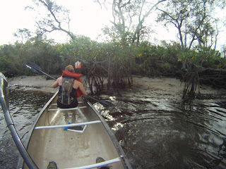
The first paddle section was moderately technical to navigate and paddle. The canals in the park were often less than 10 feet wide, and only a few inches deep in most sections. Water lilies and grasses would grab my kayak and slow progress, requiring strong paddle strokes that drained energy. Fortunately this was a relatively short paddle, around 90 minutes.

1st paddle section. Tight, shallow, and full of vegetation.

The following bike leg looked easy on paper. The first set of CPs were on trails in the park, navigation was very basic. I dropped my race passport between two CPs, lost 5 minutes riding back and found it right in the middle of the trail (whew!)

The final two CPs were a long ride south and west of the park along a dike. It was impossible to tell on the map, but this dike was mostly loose sand. Riding was not easy, and on the return leg it was mostly into a stiff wind coming directly from the east. There were two teams ahead of me at this point, and I was using a significant amount of energy on the bike trying to rein them in. In hindsight I should have backed off a few MPH and taken a 10-20 minute time loss, instead I fell behind on my nutrition and energy levels and didn't feel good when I got off the bike. Roughly 2 hours on the bike, now in 4th place overall.

Biking on the dike. It was hard packed here, but quickly turned into soft "sugar" sand.

Next, about 4 miles of trekking. All of these points were technical navigation, at least 40 meters off the trail. I had been focusing on sharpening navigation for the last 6 months, and had attended several Florida Orienteering Club O-meets. That practice paid off as I ended up in 1st place after nailing the first 3 CPs. Unfortunately that lead didn't last, as I was still suffering from the bike and mostly walking. 1 soloist (Greg from M-K/Rev3) passed me on the final 2k back to the boat TA and I started my next paddle section in second.

I can't say enough great things about this next paddle! Starting from West Indiantown Road, racers headed towards the ocean on the Loxahatchee River for approximately 8 miles. We started out going over a 1-foot spillway, with a big sign warning about alligators and cottonmouth snakes that lived in the waterway. The first section was full of old Cyprus trees, the water was a blackish-brown due to the sediment in that area, and a moderate current flowed in our direction. Yes, you read that right. An adventure race where you paddled WITH the current!!! I would have kissed the race director on the spot for making that call.

Grabbing a CP on the paddle

The Cyprus trees gave way to mangroves, the waterways opened up, and it was easy to see the evidence of large alligators along the banks. Greg even scared a few as he led the paddle, and one 10+ foot gator slide into the water about 2 feet from his boat!!! We had gotten sound safety advice from the race staff for just this type of situation: Whatever you do, DON'T get out of your boat!!

Near the end of the paddle we were going directly into the wind and once again I felt drained of energy and ready for a break. Catching up with Greg as the pull-out came into sight, we were both happy to leave our boats and those gators behind and begin the long trek.

For the next several hours I played yo-yo with team Green Paw (exiting the water in 3rd place, about 20 minutes behind me) and Greg (exiting the water just ahead of me). Too tired to run, I stood by helplessly as Green Paw and Greg would disappear into the distance on the long, straight sandy trails. However, he CPs in this section were far off trail and my navigation was on fire. So I would pass them in the bushes and end up a kilometer ahead. 10 minutes later they would go by again...

It got dark during this section of the race, and I was able to eat and drink to regain strength. Greg and I traveled together for an hour or so, I was grateful for his company and I don't think he minded slowing down for a while (he can run forever it seems!) I'm looking forward to racing with him in our 4-person coed team this April at the Rev3

Finally back to the bikes and original boat TA, I knew it was just 2 sections left until the finish. At this point Green Paw was about 1 hour in front of me, they had run almost all of the long trekking section. Very impressive. Greg was about 45 minutes behind them in 2nd. I made a very quick transition and headed out to catch Greg on the bike.

Luck was with me, I found Greg searching for the 1st CP on the bike leg. This one was diabolical...located low in a dry canal, completely blocked by vegetation (we had to crawl under some trees to get it). Nighttime navigation is it's own sport, it takes a true master to do it well. Together we cleared the last bike CPs and rode into the main TA together.

Biking at night, bright lights make a big difference! Love my Lupine lights.

At this point Greg needed to head back to his wife, as he had agreed to leave the race around midnight. They were driving to the Florida panhandle on Sunday, and he needed sleep before the 8+ hour drive. Team Green Paw was around 90 minutes in the lead, and there was no sign of anybody close to catching up. Just a few trekking points to get and likely a 2nd place finish. I left the main TA just after midnight and headed out for the final 5 points.

Up to this point in the race the terrain had been relatively dry, except for the paddle section of course. Hungryland Wildlife Management Area was a surprise...about half of the trekking we did there was in marsh/swamp with at least several inches of water. It's difficult enough to navigate at night, and to do it in a swamp, and by yourself with little sleep. What else could go wrong? Well, how about...

1) It started pouring down rain. Hard. From above. Sideways. And from below, splashes from the swamp water. Completely drenched me.

2) I startled a large cat (panther?) It gave me a very hungry look, but decided to eat something else and ran off. It...was...big.

3) Tired. I started to have trouble concentrating. Started seeing snakes in the water, no snakes. Almost fell down a few times. Just dreaming while awake.

After getting 3 of the 5 points and sitting in a metal spillway to regain body heat and attempt to dry off, I called it a night around 330am and checked back in at the main TA. It was still pouring rain. The race staff offered to let me camp out on a picnic table until breakfast and awards at 8am, but I hopped in my car and headed home instead. Well, at least I got about 30 miles before I had to pull over and sleep in the car for a few hours.

Team Green Paw won the race and cleared the course. I finished 2nd overall and 1st place male soloist. Greg would have given me a run for my money on 2nd if he could stay longer, we'll never know. But he did make it home safely the next day.

Nice job Green Paw & Greg and thanks to the staff and volunteers of the Skunk Ape Adventure Race!

~Dash

Boar Adventure Race


Authors note: Team Florida Xtreme 3 is a developmental pick-up team focused on novice racers gaining experience in running elite length courses with an experienced team captain. Race team captain is Dave "Dash" Ashley, a local racer from Merritt Island with several years of elite level racing experience and a navigator for team Florida Xtreme and Mountain Khakis/Rev3 Adventure. If you are looking to move up from the novice to elite class but would like some backup assistance the first time, drop me a line! ~Dash

Saturday 3 March welcomed back RC, Shammy, and Thumper to Team FLX-3. The 6-hour Boar AR was looking to be a hot and very windy race. The four of us had been to Christmas, Florida, back in December’s “Christmas in Christmas AR”. We knew to expect some sand, dense undergrowth, and unpredictable paddling conditions mixed in with almost a sure sighting of a few alligators!

We arrived at race HQ a 0700 when registration opened up. Avoiding the long lines we set up a sun shade, some chairs, a folding card table, and unloaded our bikes and race gear.

All smiles right before race start

RC was our lead navigator, and this was his first time leading an entire race. We checked in and he began marking up the map with our most likely routes, identifying roads, trails, off-limits areas and making measurements with a digital map measurer. The map Pangea provided was going to make navigating difficult…it was an aerial photograph of the race course, similar to what you would see on Google Maps, and lacking in detail. While it had a legend with distance, there was no printed map scale and no labeled roads, trails, or waterways. Fortunately our digital map measurer is programmable to common map scales and is user-programmable, so we used the legend to program the map reader (about 1:11,000) and were all set to mark meters and kilometers for our planned routes.

Lesson learned #1: Always bring something to measure the map with, and be flexible if you don’t get a “standard” adventure racing map (1:24,000). You can use a fancy digital tool, a piece of string, or make your own plotter with a piece of paper cut at 90 degrees, a pencil, and the legend provided on your map.

Arriving 2 hours before the race start was a great idea, and we had ample time to mark up the map, pack our gear, and make one final visit to the port-a-potty before the race started at 0900. Order of race was either bike or run first (teams could choose), then bike from main TA to paddle put-in, run from paddle take-out back to paddle put-in, bike back to main TA, then either run or bike (whichever you did not do to start the race), and ended with a final combined bike/run.

Since the weather forecast was calling for 88 degrees and it was only in the mid 60’s at race start, we opted to run first.

Lesson learned: Running consumes more calories and generates more body heat than paddling or biking. Given a choice, always run in the coolest times of the day.

RC did outstanding during the run section, we hit all the checkpoints on our first attack and ended up back in the main TA in the middle of the pack. We hoped on our bikes for a short and uneventful pedal to the canoe section.

Jogging across a Florida cow pasture

Here is where things got interesting. If you have never raced in Florida or some other swampy location, it’s hard to imagine how difficult navigation can be when there are multiple channels, dead-end creeks, 10-foot high reed grass, and lots of mud, plants, and countless unfriendly critters out there. To top off that list, the wind was blowing around 15 mph steady and gusting over 20. The paddle was TOUGH.


Beautiful sunny day for a paddle

We found the first few points quickly, but then it was around 45 minutes to locate two CPs that were hidden deep in the reeds. For both points we made the mistake of continuing past our initial attack point, spreading out and looking around without maintaining our bearing, distance, and map location. CP 15 was a real morale-buster, as it was only 50 feet from our initial attack point but we moved away from it during our first search. Later in the race we discovered that several other teams just gave up on these CPs. It turns out we would have been able to gain several more points if we had cut our losses earlier, as we didn’t “clear” this course and there were easier CPs later in the race that we ended up missing due to the time cut-off of 6 hours.


Infamous CP 15

Lesson learned #2: If you don’t locate a CP on your first attack, re-group the team, get back to a known location on the map (trail intersection, key terrain feature, bend in river, etc) and re-attack the point. It’s almost always faster than continuing to search, moving further from your initial attack point and likely getting lost in the process.

Lesson learned #3: Identify your likely difficult/time consuming CPs before the race. Assign a time cut-off for those points if you can’t locate them, and be prepared to skip a CP if you are likely to get more CPs later by doing so. At the end of the race it’s the total number of CPs each team gets that determines the winner, there is no penalty for skipping a CP.


It looked shallow!

After almost 3 hours we finally cleared the paddle and had a short jog back to our bikes. Two teammates were showing signs of heat exhaustion at this point: Sweating heavily, not very responsive in conversation, tiring easy on the run, and complaining of cramps. For the last 2 hours of the race they continued to slow down despite drinking extra water and taking electrolyte supplements.

Lesson learned #4: Don’t get behind on food, water, and electrolytes in a race. It takes time to re-hydrate, digest food, and stabilize electrolyte levels. In a race you have to be ahead of your nutrition or your performance will decrease steadily until you’ll have to stop and deal directly with the side effects (cramping, blacking-out, dizziness, low-blood sugar bonk). I strongly recommend using a stopwatch timer set to continuously count down for a reminder to drink and eat, and always dissolve electrolytes in drinks.

Despite suffering from the heat, RC continued to navigate dead-on back to the main TA and out for our bike section. We arrived back at the main TA again with the combined bike/run section remaining, but only 10 minutes until the cut-off. Of the last 7 points remaining in the race we only collected one before returning to the race finish at just under the 6-hour cut-off. Very hot and tired, we dropped our bikes and did a toast with some ice-cold beverages. Another race complete!

Beautiful sandy fire roads in central Florida

Wrap up from the Boar AR:

  • No bike mechanical issues
  • 2 teammates had heat exhaustion
  • 2 points we had extreme difficulty finding during the paddle
  • 1 Alligator sighting
  • 1 “mystery” animal brushed up against Thumper’s leg underwater while in the swamp
  • 1 canoe almost flipped over (soooooo close)
  • 1 teammate threw up (I promised her I would not say who….)


Thumper, Dash, Shammy, and RC (L to R)

Come join FLX-3 for the next Pangea race, the Myakka Mud Slide, on 31 March!

~Dash

Click here for a GPS map of our race thanks to my Garmin Forerunner 310XT:

Monday, February 13, 2012

Courain Brothers compete in NYARA Hike-A-Thon

Rev3\Mountain Khakis Adventurte Racing Courain Borthers compete in the
NYARA Hike-A-Thon


John and I got an early start on saturday morning and headed up to Sterling Forest, NY for a fun trail race. This year at registration we found out that UPS had misplaced a large box of NYARA thongs, so we all got visors instead, which are much more acceptable to wear in public. We registered and got our maps for the course, which turned out to be a 20.07 mile loop through the sterling forest park. The mild winter so far actually threw us for a loop and brought about an inch of snow the previous night, making the course a little more fun in my opinion. Our hopes for this race were to do well, but still treat it as a winter training session. We had a plan to take the hills easy in order to save our legs, but keep a quick pace wherever else was possible. wearing the mandatory backpack with 10% of your body weight was a nice way to add in some resistance for the already challenging terrain. After the 9 am start, we quickly fell into a comfortable pace, while keeping to our plan, trying to not get in a footrace with all of the other runners, but just focus on what we were trying to accomplish with our training, and avoid an overuse injury. About an hour into the run, we were well spaced out, with one person out in front of us, and the rest of the group behind us out of sight and sound. entering into the 2nd hour of the run, we started on the most technical section, a ridgeline, which gave us great views of the lakes and surrounding areas, but the steep ups and downs along with twisty narrow singletrack did slow the pace quite a bit.after the last bit of ridgeline, we took a long descent down some torn up fire road, with lots of loose rocks and mudpits which made for an interesting choice of lines, and further made it difficult to open the pace up. Once we were out of the lowlands, the trail firmed up and we had a solid run back towards the finish line. The last section of trail circumnavigated the lake, where we started, and stayed relatively flat and open, which was a nice way to finish the run. When we got to the finish, John opened up his stride just enough so that he could say he beat me, but we were very happy with our place of 2nd and 3rd, and time of 4:50. my altimeter showed just under 3k feet of total elevation gain for the run, and we stuck to our race plan and finished injury free, which is another success. This was a great way to wake our legs back up for the upcoming season, and get us pumped!


Monday, January 30, 2012

Treasure Coast AR Race Report: Team FLX-3


Setting up my new GoPro Hero HD camera for the race

Authors note: Team Florida Xtreme 3 is a developmental pick-up team focused on novice racers gaining experience in running elite length courses with an experienced team captain. Race team captain is Dave "Dash" Ashley, a local racer from Merritt Island with several years of elite level racing experience and a navigator for team Florida Xtreme and Mountain Khakis/Rev3 Adventure. If you are looking to move up from the novice to elite class but would like some backup assistance the first time, drop me a line! ~Dash

Saturday January 28th welcomed 3 new racers to Team FLX-3: Jeanette, Stef, and Wesley. The 6-hour Treasure Coast AR would be the longest race yet for all three. Weather was forecasted to be sunny, low 70s, and little wind. Perfect conditions and in a perfect location, Jonathan Dickinson State Park near Hobe Sound, Florida.

Here is a quick rundown of the team:

Jeanette: Completed about 10 ARs, mostly Pangea sport races with a few of the shorter Elite events. Former soccer player and gymnist, looking to gain experience navigating. Master’s degree in Electrical Engineering, wow!

Stef: Completed about 7 ARs, Pangea sport races, also training for a marathon. Strong cyclist, looking to gain experience navigating. Very fit, killed this race physically!

Wesley: Completed 2 Pangea sport races with family/friends. Strong paddler, and looking to gain experience from racing with an elite team in a longer race. A loving husband, brings his wife to the race and sets her up in style with a tent, chair, and cooler full of cold beverages!

I was a little nervous meeting up with three strangers for a 6-hour race. Teamwork and chemistry are so important in adventure racing, this was the equivalent to going all in and not even looking at your poker hand! Well, live a little, right?

Things started off pretty well, as I showed up to the race registration about 15 minutes late and was able to locate all three of my teammates after a few minutes.

Lesson learned: Plan to arrive early. The directions only put us at the front gate of the park, the race start area was another 10 minute drive from there! We lost valuable time that could have been spent analyzing our maps.

After gathering all of our gear into one spot and snagging one of the few picnic tables, Jeanette and Stef started looking over the maps and clue sheet. Since this was Wesley’s 3rd race, we spent some time going over some race fundamentals such as what gear was needed and how to pack for a 6 hour race, options for hydrating and fueling, differences between canoe and kayak paddles (we brought kayak paddles for this race), and some of the key differences between the many types of mountain bikes.


From left to right: Stef, Wesley, and Jeanette

Jeanette used a cool tool I had never seen before. Using a small piece of colored wire, she would bend the wire into the shape of a trail on our map to measure between two checkpoints. Marking the length with her finger on the wire, she would then straighten the wire and measure the distance off the map scale. It was quick and easy to measure the distance between two points, even if the route curved back and forth. As we would soon find out, our “map” only showed about half the trails that were actually out in the park. If we didn’t know the distance to travel and use a cycle computer or pace count to measure, we could have easily gotten lost. Nice work Jeanette!

Lesson learned: Don’t trust your map to show all the roads and trails. Measure your map and keep track of your distance, this will help reduce the possibility of turning too early or missing your turn. Some racers use different techniques, such as a string, a mechanical or digital measuring tool, and some experienced navigators can eyeball distance accurately.


After working the map, red shows our travel path and distances

The Treasure Coast Elite AR was composed of 4 sections. All teams must first do a short (~3k) trek, followed by a moderate (~10k) paddle. After that, teams had to accomplish both a moderate (~10k) trek and long (~20k) bike but could pick the order, either bike/run or run/bike.

Stef started off navigating, and Wesley was our “rabbit” and had the job of punching our passport at the checkpoints. The first trek was entirely on a nature trail and was very straightforward, with the typical “choo-choo train” of 16 teams heading off in the same direction. Stef masterfully navigated us through this section.


Race start, noticeable "choo-choo train" of teams

Following the short trek, we sped through transition and grabbed our kayak paddles. There was a short line to launch canoes, then we were treated to a beautiful paddle through mangrove-lined waterways with glassy conditions. Jeanette flawlessly lead us through this section, while Wesley and Stef showed off their paddling skills.


In line to launch canoes

Lesson learned: We all had kayak paddles, and it paid off. We were faster than teams with canoe paddles. The wide channel and relatively little overhanging vegetation was perfect. If the waterway was narrow, or had more overhanging trees, canoe paddles would have been the better choice. Bring your own paddle to the race, and make the decision once you see the park and map.

We opted to avoid congestion with the flotilla of other canoes in the narrow sections of the creeks, and went back to the furthest checkpoints first. That strategy rewarded us with some quiet time on the water where we didn’t see any boats, and we were able to gauge how fast other teams were moving as they passed us on our way back to catch the earlier points. We easily found all the points and were quickly back at the main transition area.


Snagging a paddle point

Lesson learned: Often, paddles are “out and back” and some of the points along the way you have the option of getting now, or when you return. Keep an eye on them as you go and grab them if convenient. If other teams are clogging the shore, or you don’t see a point the first time you go past, it’s often easier to get it and/or see it when you are returning the other direction. So don’t sweat missing one if you can grab it on the return trip!

Next we had the option of the long bike or moderate trek. We elected to bike first, and with another quick transition (great job team!) we headed off with Stef navigating, Jeanette marking distance on her cycle computer, and me rabbiting.

Not nearly as much sand as FLX-3 encountered in the Resolution AR, JD Park certainly had some of the deep stuff out there. Most of our checkpoints were right off trails, but far enough that you had to know where to look. And there were a maze of trails that didn’t show up on the map, while some of the map trails were incorrectly marked. A typical adventure race!

Stef did a great job of keeping us in a “known” location for most of this section. He communicated with the rest of the team when he was not sure, and several times Jeanette, Wesley and I were able to help keep the team on track. With a little bit of luck and a brazen bikewhack move that paid off, we finished the bike portion and moved up the leaderboard several positions over other teams. At this point we had about 90 minutes left to race, the temps were warming up, the sun was beating down, and we were all getting tired. Time for a 10-k sand run!

Lesson learned: The navigator should regularly communicate with team members and use their eyes to help locate key terrain features. A strong navigator will let the team know how far until the next turn or checkpoint, which direction they should be heading, and any other details that will help the team stay in a “known” location while racing. Team members should all know how to use a compass, pacecount, and have a cycle computer with an odometer set in kilometers. This philosophy saved us several times during the Treasure Coast race.

With a slightly slower transition to remove some of the bothersome burrs that we collected during the bikewhack, team FLX-3 headed out for the last leg. We already knew that time was short, we were tired, and any serious navigation error would cost us a point at a minimum, and likely several slots in the overall placement as well. Only 10k to go!!

Stef was handling the long race and heat well, so after a quick huddle we elected him the navigator for the final section. I rabbited and counted pace. Jeanette and Wesley were both getting winded, and worked together motivating each other to keep pushing. While nobody was severely worn out, we discussed things a team could do when one team member “hits the wall”. Stef had a tow rope that we practiced with, while Wesley experimented with holding on to the pack straps of the person running in front and slightly to the side for some extra speed. Even with a pace count we had difficulty finding two of the three points, but ended up with a full control card and headed back to the finish with only minutes to go.


I dare you to bushwhack through saw palmettos!

Lesson learned: Teams must stay together at all times in adventure racing, so you are only as fast as your slowest member. Pair up your strongest paddler with your weakest. Provide a push on the back during straight bike sections, or carry a tow rope. If needed, you can tow on the run as well. But I only recommend this if you are close to a cut-off time on the course, or going towards the finish line. Towing on the run can easily wear out both members, so don’t do this early in a race!

Team FLX-3 completed the Treasure Coast Adventure Race in just over 5 hours 42 minutes and in 5th place overall. It was an impressive finish, as only 5 teams out of 16 “cleaned” the course with all checkpoints. Jeanett, Stef, and Wesley had just finished their longest race…ever! Their navigation was stellar, and everybody stayed positive on the course. Not too bad for 4 people who were complete strangers at 7am that morning!

Looking forward to seeing the folks from Pangea and team FLX at the Boar AR in March!

~Dash

Monday, January 23, 2012

Resolution Adventure Race: Race Report


Authors note: Team Florida Xtreme 3 is a developmental pick-up team focused on novice racers gaining experience in running elite length courses with an experienced team captain. Race team captain is Dave "Dash" Ashley, a local racer from Merritt Island with several years of elite level racing experience and a navigator for team Florida Xtreme and Mountain Kahakis/Rev3 Adventure. ~Dash

January 14th had the promise of a fantastic day for racing in central Florida, just West of Orlando on lake Lousia. Temps were only supposed to reach into the high 60s, although the night prior was cool by Florida standards. FLX-3 members for this race (Dash, RC, Thumper, and Shamrock) met up right when registration opened at 0630 to check in and get our maps. It was still dark and felt quite cold. We all hoped the paddle would be later in this 8-hour race...brrr! No jokes about Florida for all of you dealing with snow and worse up north!

We set up some chairs, said hellos to the race director Greg, his staff, the volunteers, and some other racers, then settled down to examine the map and clue sheet. First impressions were good, this course look fairly short for an 8-hour event and the paddle didn't look very difficult at all for an adventure race. Flat water paddling, no creeks, and fairly short! The course was divided into several segments, the order was run, bike, paddle, run, bike. The hardest sections looked like the last two, as they were by far the longest run and bike sections. Barring any unfortunate circumstances (getting lost, injured, or a mechanical problem) the course looked straightforward and not too difficult to "clean." Notice the use of foreshadowing…

For this race we had decided to share the navigation between Shamrock, an experienced racer, and RC, who only had one race and orienteering meet (Florida Orienteering Club) under his belt. Both did a great job on this moderately technical course.

Shamrock navigated the first leg, about 5 k. The "choo-choo train" effect of the beginning of the race made navigation a breeze. We were surprised to see a 3-female team pushing hard on the return from an out-and-back point. They were in 1st place already and looking determined to shoot for the lead. Way to go ladies!

The 2nd leg was a short bike, but with an interesting decision point. You can either backtrack about 2 miles in mixed sugar sand on bike, or "hike a bike" across a waist-deep creek about 100m to shortcut to the next CP. 2 teams with us elected to backtrack. Well, we decided that it looked more fun to brave the possibly alligator-infested water so I volunteered to cross the creek. (Editor’s Note: I recently learned that gators this time of year are pretty docile due to the cooler temps; somehow, this information is only mildly reassuring.) It quickly rose to my waist in the first few steps and my feet started to get mired in the mud...so we looked up and down the creek and found a log crossing. That worked great...it was a treat that 3 of us had lightweight bikes for this part (titanium and carbon frames, low 20lb range). Shamrock rides a real brick, makes a huffy look like an upgrade, and halfway across the log we heard a "crack!" and just like that the log broke apart and fell into the water. He made a leap and hit the far side, but 3 other racers following him didn't have the same luck. We saw one face-plant into the middle of the creek with his bike. Did I mention it was around 45 degrees?? (Quit with the Florida jokes already!)

After a fairly difficult bike-whack through some dense palmettos, we caught the trail again. The 2 teams that had elected to backtrack and make the longer bike went sailing by us as we were looking for our CP. Best guess we lost about 3 minutes to them and spent a fair bit of energy in the bike-whack. But I can guarantee we had more fun! Finally we rolled up to the bike-to-paddle TA.

We paired up, grabbed 2 canoes, paddles, and lifejackets, then portaged the boats for about 100 meters towards the lake. Then bad news: whitecaps on the lake. It was a strong wind, and the shallow Lake Louisa had waves about 12 inches high and blowing directly on-shore (north to south). Our first point was 200 meters west, crosswind, and looked to be a daunting paddle. We could already see one team had flipped their canoe in the waves. Hopping in, the wind immediately pushed our canoes into each other and Shamrock/RC flipped. Hey guys, that water looks really, really cold!!! The thing about Shamrock and RC, they are both over 6 feet tall and around 200lbs. Very fit guys, but a large profile and top-heavy on a canoe. On the 2nd try we had better luck and managed to make very slow progress, paralleling the shoreline towards the next CP. RC was paddling in front and sat on the bottom of the boat to increase stability. In each boat the paddler in front had to continually paddle on the left side to keep the canoe from turning away from the wind, and the rear paddlers were working overtime attempting to make forward progress. As Shamrock and RC's boat flipped a 2nd time, we all decided it was faster, easier, and safer to just drag our boats in the shallow water by the shore to the CP. Other racers in front and behind us were doing the same thing, and we quickly made the 1st paddle CP.

this point we were still in the wind, very wet, and getting close to hypothermia. Time for a short team discussion. Should we continue the race? Should we cut short the paddle section? Everybody had a different opinion. In the end we discussed the team goals...no stopping with time and CPs still on the course! So much for an "easy" adventure race.

After dragging/carrying our boats another 300 meters, it was time for a change of plan. We could not continue stepping in the water it was just too cold. With around 10k left on the paddle we simply could not carry our boats on land the entire way and finish the race in 8 hours. A quick check of the race rules...nothing here says you NEED to carry your canoe, paddles, and life vest to each CP. So we dropped them at the paddle-trek transition area and jogged the remaining paddle course. Greg, we dare you to DQ us!

I really don't recommend doing this. Paddling is faster than jogging. It takes much, much less energy (even into the wind). You don't have to cross private property in the canoe, nor do you have to follow the entire coast line to get to a CP. But if all else fails (and the rules don’t prohibit it) it works.

I'll save the stories of meeting land owners as we cut through their backyards, neighborhood children giving us directions, and watching teams of strong paddlers sail off into the sunset (and up in the leader board) for another discussion. It was a humbling time. Over 2 1/2 hours later, we finished the "paddle" and transitioned to the long trek.

With 4 hours to go, "cleaning" the course still looked very possible. The long run on the "paddle" section slowed Thumper down a bit, as none of us had trained to run so much (it ended up around 15 miles total that day). We encountered deep sugar sand during much of this section, further sapping our energy levels. Fortunately Thumper and RC had set recurring timers on their watches. Thumper's was for every 20 minutes as a reminder to drink. RC was every hour as a reminder to eat food. We never ran into dehydration or the dreaded "bonk" of low blood sugar on this race. Shamrock was killing the navigation, and we hit every checkpoint on the first try with minimal searching. Pushing hard at the end, we made the final transition trek-to-bike with just over 2 hours remaining. We were smoked.

Then more bad news.

Two bikes had flat tires. One was a simple tube, easy to fix. However I run tubeless on my Specialized Epic S-Works, and it is usually a godsend. No pinch flats, self-sealing punctures, tubeless is the only way to go for advanced racing. But for some reason I had a flat. What the heck??!!??

After about 45 minutes of trouble shooting, we narrowed the problem down to my valve stem. Air was leaking around the seal. Simply tightening up the nut stopped the leak. Meanwhile we had run through 2 tubes on the other bike (cheap replacement tubes were splitting) and used up all of our CO2. On our last tube, we used a hand pump and all our tires were finally full. We took off!

And finally, more bad news. We missed a CP with a navigation error, and got another tube flat. With no more usable spares (patching didn't work) and a bent valve stem on the only good tube, we were completely out of the running to get all the CPs. Even worse, we were located about 4 miles from the race start with only 30 minutes to get back...carrying a bike. Another decision point. Do we just have one member ride back, get a car, and drive back to the finish? Or do we tough it out? We elected to carry/push the bike back to the start line. We finished around 40 minutes past the cutoff – a huge disappointment after working so hard all day.

Looking back, what could we have done differently?

Certainly the paddle hurt our time and energy. Paddling together as a team may have given us the skill to make it across the lake in our boats. Once there, coming back into the wind would have had us off the paddle leg about one hour faster than running.

The bike mechanicals killed us late in the race. We packed well, with lots of CO2, spare tubes, a pump, and a patch kit. I had never seen a valve problem before on my tubeless tires, that won’t happen again. And our handpump was very difficult to work, putting lots of strain on the fragile valvestem when attempting to make the 200+ pumps to fill a 29-er tire. This week I ordered a new pump with a flexible nozzle on the end. You screw it onto the valvestem of your tube, and when pumping you don’t risk breaking/bending the valvestem. Oh, and bring more CO2. It’s way, way better than pumping!!!

Another great race from the folks at Pangea. Thanks go RC, Shamrock, and Thumper for giving 8 hours (and 40 minutes!) of their all until the very end. We’ll be ready for the next one….will you?


Next race: TreasureAdventure Race in Jupiter, Florida on Saturday 28 Jan.

~Dash

Sunday, January 8, 2012

QOC Meet at McKeldin

We made the most of the mild weather today for a winter training session at the McKeldin area of Patapsco. I had only been to the east end of Patapsco and this area was new to me. I met up with Liz, who is planning on racing with Rev3 in 2012. We hit the trails for an hour of mountain biking.  The area has about 8 miles of bike-able trails, all in good condition.  Not too technical, a few steep climbs and some nice fast downhill sections.  Liz and I tied together the white, red and purple trails for about 8 miles of riding.
After the ride we hung around a bit waiting for Dennis to arrive and then hit the Brown O course set up by QOC. It was a nice loop with 8 controls.  No heavy undergrowth was present so all point to point navigation was easy.  We worked around the course in about 50 minutes and then enjoyed some of the snacks put out by the club.  Those guys really know how to put on a great meet.


Orienteer Your Snowballs Off 6 Hour ROGAINE

January 7, 2012
Rev3/MK Racers: Britt and Cory Mason

Race Report by Britt Mason

Early Saturday morning, my brother Cory and I traveled to Rock Cut State Park in Loves Park, Illinois, for the inaugural Orienteer Your Snowballs Off, a 6 hour ROGAINE orienteering race. The day promised to be gorgeous for Illinois in winter, with temps getting up into the 40s and sunny. We received our map and worked out a route, planning to try to clear the course. The race would consist of 43 CPs with a 6 hour cutoff. After a brief pre-race meeting, we were off!

The navigation proved challenging right from the start, as all trails were removed from the map, and points were plotted using GPS. In addition, the park had very little elevation change, so the topography was subtle to say the least. About an hour into the race, we found ourselves searching for a CP with another team, Heather and Rich from Eyes of the World/Team Randomocity. After 20 minutes with no success, we realized we needed to move on if we were going to manage our time well for the rest of the race. We had even gone to the next CP to use it as a reference and come back. We decided to press on, effectively beginning a great partnership with Heather and Rich for the rest of the day. Cory and I have never raced with anyone else or partnered with another team. We had a blast feeling like a 4-person team and spending time with a couple of awesome racers. On several occasions, the vegetation was so dense we literally had to army crawl to get through it. I'm sure taking trails would have been faster, but without knowing the trail system in the park, we had no choice. The course itself was fantastic, taking teams through the entire park and creating endless route choices. Getting to some of the CPs was interesting and included: climbing a tree, crawling into a tiny cave, walking out on a fallen tree above the thin ice of the lake, and running in the frigid water through a long culvert and back.

As the hours slipped by, we had to make a couple of route choices to skip CPs in order to beat the cutoff. We crossed the finish line with Heather and Rich with less than 10 minutes to spare. We cleared 35 of 43 CPs and effectively tied for 3rd place. We covered 17-20 miles for day on foot and had a great time doing it! Next up is the Bonk Hard Chill in Lake of the Ozarks, MO, on February 18. Hope to meet you all at the Epic!